Platform

The platform under every module

The same six capabilities sit under every module, military or civilian: offline-capable, permissions enforced at the database, multi-base tenancy, PDF export with no server in the loop, deliverable email, and a maps engine instead of a list.

Works where the connection doesn't

The app installs like any other app, on a phone, a tablet, or a laptop: an icon on the home screen, no separate browser window, no app-store update cycle to sit through. Once it's installed, it keeps working when the network drops.

A check, an inspection, or a status update made with no signal writes to a queue on the device instead of failing outright. The moment the connection returns, that queue syncs in the background and the record lands where it belongs.

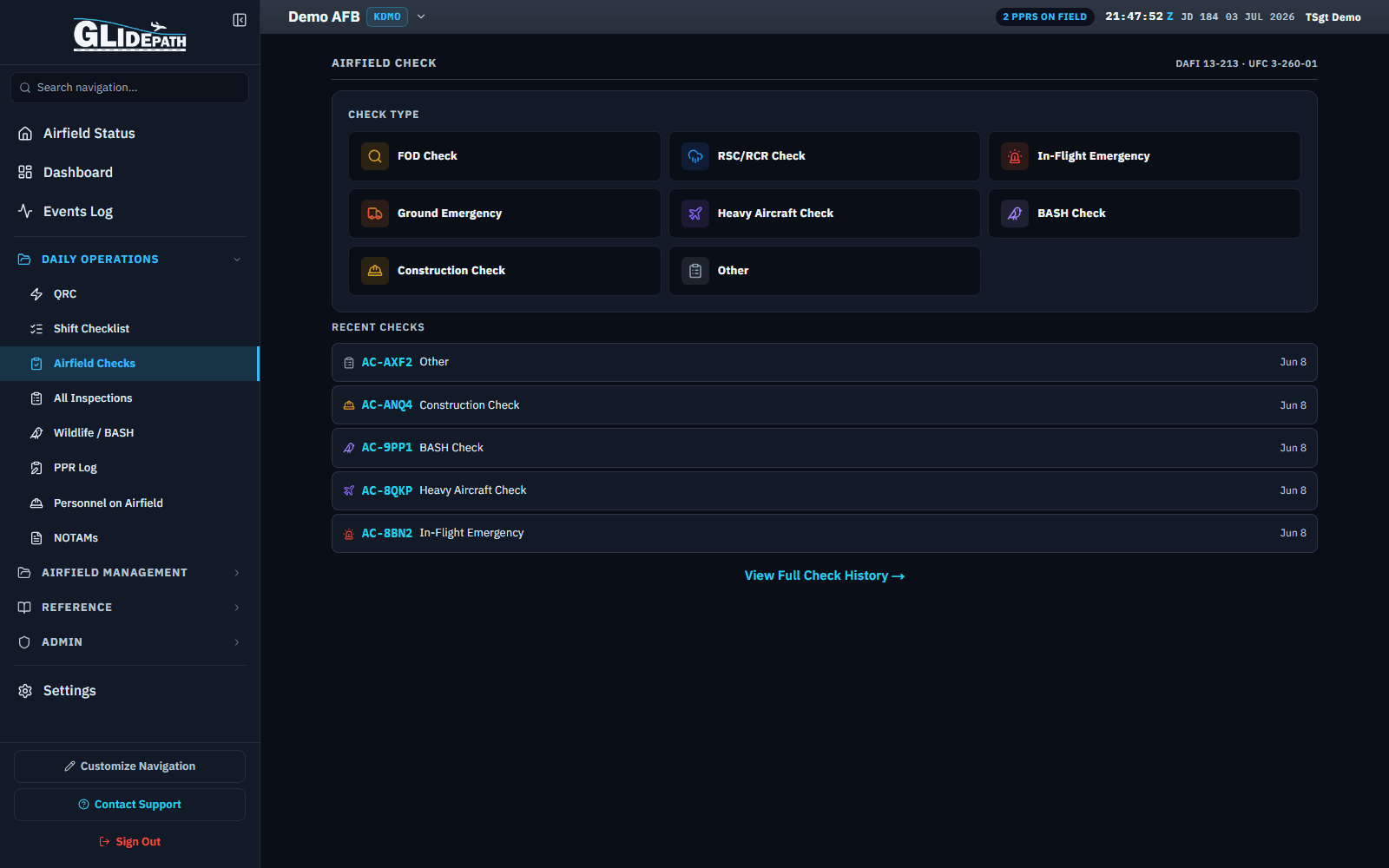
Airfield Checks list for a demo airfield, with check types and recent entries
The Airfield Checks list for Demo AFB: eight check types (FOD Check, RSC/RCR Check, In-Flight Emergency, Ground Emergency, Heavy Aircraft Check, BASH Check, Construction Check, Other) and five recent entries logged Jun 8, each with its own check number.

Permissions enforced in the database

Every role on the roster (Airfield Manager, Base Admin, a read-only auditor, and everything between) is crossed against a matrix of permission keys, one row per role and one column per action. That matrix is the single source of truth for who can see or change what, not a setting scattered across a dozen screens.

The enforcement point is the database itself, through row-level security, not a button hidden somewhere in the interface. A request the matrix doesn't allow gets rejected server-side, so the access rule holds even if a screen renders something it shouldn't, or a request skips the interface entirely.

One account, many airfields

An account isn't tied to a single airfield. Whoever needs visibility across more than one base (a MAJCOM Functional Area Manager or a Regional Functional Manager, a contractor working several installations, an Airfield Manager covering a detachment) switches from one base to another without logging out and back in as someone else.

Every base's data stays isolated from every other base's: inspections, discrepancies, personnel, and the rest of the record belong to the base that produced them. Switching bases changes what you're looking at, not what exists underneath it.

Airfield Status board for Demo AFB (KDMO), showing the base name and code in the top bar
The top bar reads Demo AFB with a KDMO badge beside it. Behind it, that base's Airfield Status board: runway 01 open (RSC Dry, BWC LOW), NAVAID status broken out by runway end, and ARFF readiness shown as A-10 Optimum and K35R Reduced.

Documents generated on your machine

Every report, from a single inspection to a full records export, renders as a PDF in the browser itself. Nothing gets uploaded to a third-party rendering service and handed back as a file; the document is built on the device that requested it.

That matters most for the record itself: an inspection log, a discrepancy history, a training file. None of it transits a third-party server on its way to a PDF when exporting.

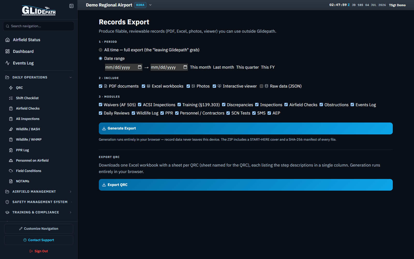
Records Export screen for a demo civilian airport, with format and module checkboxes and a Generate Export button
The Records Export screen for Demo Regional Airport: a date-range period picker, format checkboxes (PDF documents, Excel workbooks, Photos, and Interactive viewer checked; Raw data JSON unchecked), fifteen per-module checkboxes, and a Generate Export button, with a note that generation runs entirely in the browser.

Mail that reaches operational inboxes

Invites, password resets, and PDF distribution all send as Glidepath (Glidepath Technologies, LLC), not a generic notification address, with replies going to info@glidepathops.com.

The messages themselves stay plain-text-friendly by design, because strict mail environments (base networks, government filters, anything running an aggressive spam policy) are more likely to deliver a plain message than one built entirely out of images and tracking pixels.

The airfield as a map, not a list

Most of what the app tracks has a location, and the maps engine is where that location lives: a satellite base layer under everything, with feature maps for lighting and signs plotted at their real positions instead of buried in a table.

The same engine runs the math behind parking plans and obstruction evaluations: clearances, surfaces, and the geometry that decides whether an aircraft or an object actually fits where someone wants to put it. That calculation runs against the airfield's real geography, not a schematic stand-in for it.
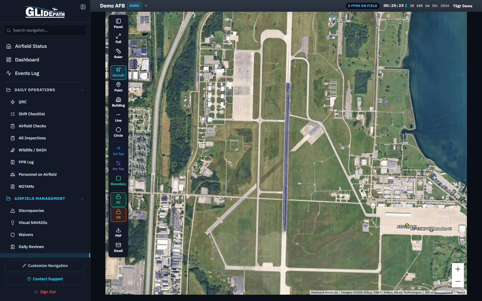
Satellite parking plan for a demo military airfield with drawing tools and placed aircraft
A parking plan for Demo AFB on the satellite base layer, with aircraft, point, building, line, and circle drawing tools in the left toolbar and two placed aircraft (an A321-200 and a KC-135R/T Stratotanker) on the ramp.